File:WilmingtonOilField.jpg

Original file (3,300 × 2,550 pixels, file size: 496 KB, MIME type: image/jpeg)
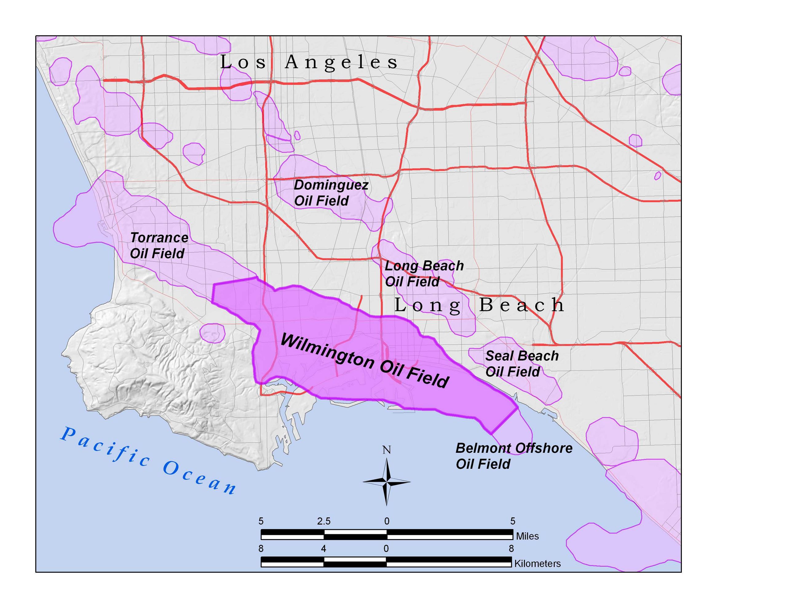
Wilmington Oil Field within the Los Angeles Basin, California, U.S. All data shown on this map is in the public domain. Created by User:Antandrus using ArcGIS 9.2 and posted to wikipedia; data sources include US census TIGER data (2000), USGS national elevation dataset, and California Department of Natural Resources file of oil field boundaries.
Permission is granted to copy, distribute and/or modify this document under the terms of the GNU Free Documentation License, Version 1.2 or any later version published by the Free Software Foundation; with no Invariant Sections, no Front-Cover Texts, and no Back-Cover Texts.
This work is licensed under the Creative Commons Attribution-ShareAlike 3.0 License.
This licensing tag was added to this file as part of the GFDL licensing update.
File history
Click on a date/time to view the file as it appeared at that time.
| Date/Time | Thumbnail | Dimensions | User | Comment | |
|---|---|---|---|---|---|
| current | 18:29, 10 April 2010 | | 3,300 × 2,550 (496 KB) | Believethesign (talk | contribs) | Wilmington Oil Field within the Los Angeles Basin, California, U.S. All data shown on this map is in the public domain. Created by User:Antandrus using ArcGIS 9.2 and posted to wikipedia; data sources include US census TIGER data (2000), USGS national ele |
You cannot overwrite this file.
File usage
There are no pages that use this file.